HIGH-resolution maps of the complex landscape beneath a major West Antarctic glacier could prove valuable for helping forecast global sea level rise, researchers led by Edinburgh University say.
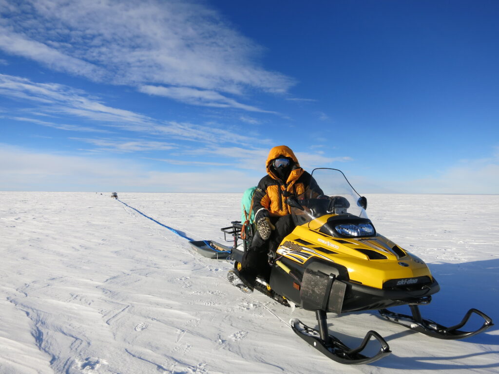
New radar surveys of the land beneath Pine Island Glacier, obtained by teams out using snowmobile, have revealed what they say is a surprisingly diverse, mountainous landscape under the ice.
And the findings could prove hugely significant.Pine Island Glacier is the fastest melting glacier in Antarctica and currently accounts for up to 10 per cent of global sea level rise.
Ice melting into the ocean is expected to increase in the region as the climate warms and the West Antarctic ice sheet continues to thin.
The survey of the glacier, the most detailed to date, was carried out during the Antarctic summer of 2013 – 2014 by a team working round the clock.
Snow vehicles equipped with radar sensors surveyed about 1500 sq km of ice, taking readings every few hundred metres.

The findings represent significant progress in the data available to inform forecasts of ice loss.
They say previous computer models used less comprehensive data from aerial radar surveys, which did not account for a range of ice bed shapes and the effects these could have on glacier friction.
The study also shows that the diverse nature of the terrain beneath the glacier is the biggest factor affecting the flow of the ice across the landscape.
Scientists will now incorporate the new findings into computer models used to project the glacier’s future.
The study, published in Nature Communications, was led by the University of Edinburgh in collaboration with the British Antarctic Survey, the Universities of Swansea, Exeter and Aberdeen, and partners in the US and New Zealand.

It was funded under the Natural Environment Research Council’s iSTAR programme.
Dr Robert Bingham, of the University of Edinburgh’s School of GeoSciences, who led the research, said: “Detailed understanding of this diverse landscape, and how that will impact on ice melt from Antarctica’s fastest disappearing important glacier, will give us valuable clues as to how warming in this region will impact on global sea level.”
Damon Davies, of the University of Edinburgh’s School of GeoSciences, who took part in the research, added: “Pine Island Glacier is a key contributor to sea level rise, so this major step forward in understanding its dynamics will help improve our predictions of ice melt into the ocean.”
Scientists admitted they were surprised by their discoveries.
Professor David Vaughan from British Antarctic Survey, who co-led the study, said: “These maps have revealed new features under Pine Island Glacier that we never thought were there.
“The bed turns out to be much rougher than we thought. There are mountains and deep scour marks which are clearly going to be influencing the flow and behaviour of the ice.
“In order to really understand how the glacier is going to respond to future change, we need to understand its interaction with the bed and these high resolution maps let us begin to do this.”
WANT TO LEARN MORE? Read: Diverse landscapes beneath Pine island Glacier influence ice flow
IMAGE CREDITS: University of Edinburgh